1/14


São Paulo Metro - Official
1K+다운로드
37.5MB크기
12.1.10(18-12-2024)최신 버전
세부 정보리뷰버전정보
1/14
São Paulo Metro - Official의 설명
"상파울루 메트로 - 공식"응용 프로그램이 지하철 시스템을 사용하여 작성된 상파울루 주변의 약속과 참여로 경로를 매핑하고 계획하는 가장 빠른 방법입니다.
METRO - 응용 프로그램은 상 파울로 수도권 철도 회사의 이니셔티브이다.
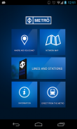
기능 및 리소스 :
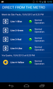
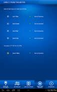
- 지하철에서 직접
각 라인의 작동 상태를 실시간으로 추적.
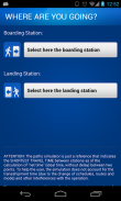
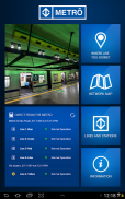
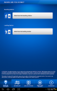
- 어디가는거야?
예상 시간 및 비용을 포함하여 두 스테이션, 동네지도 등 사이에 가장 빠른 경로의 단계별 시뮬레이션
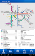
- 네트워크지도
모든 지하철 라인의 시각적 인지도.
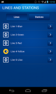
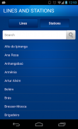
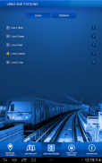
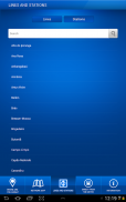
- 선 및 역
모든 지하철 라인과 방송국을 볼 수 있습니다. 영업 시간, 위치 등을 참조
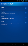
- 정보
개인 방송국 요금, 지원 전화 번호, 서비스 시간을 볼 수 있습니다.
좋은 앱임을 보장합니다이 어플리케이션은 바이러스,멀웨어와 기타 악의적인 공격에 대한 보안 시험을 통과하였으며 어떠한 위험요소도 포함되어 있지 않습니다.
São Paulo Metro - Official - APK 정보
APK 버전: 12.1.10패키지: br.com.metrosp.appmetro이름: São Paulo Metro - Official크기: 37.5 MB다운로드: 391버전 : 12.1.10출시 날짜: 2024-12-18 02:55:42최소 스크린: SMALL지원되는 CPU: x86, x86-64, armeabi-v7a, arm64-v8a
패키지 ID: br.com.metrosp.appmetroSHA1 서명: A7:68:BD:17:EB:0A:21:34:93:D9:D7:01:60:23:07:A5:A2:70:6C:1E개발자 (CN): Companhia do Metropolitano de São Paulo - Metrô단체 (O): 로컬 (L): 나라 (C): 주/시 (ST):
São Paulo Metro - Official의 최신 버전
12.1.10
18/12/2024391 다운로드37.5 MB 크기
다른 버전들
12.1.9
10/6/2024391 다운로드37.5 MB 크기
12.1.4
29/2/2024391 다운로드37.5 MB 크기
12.1.2
2/2/2024391 다운로드37.5 MB 크기
12.1.1
5/1/2024391 다운로드39 MB 크기
12.0.0
4/11/2023391 다운로드37.5 MB 크기
2.7.6
15/12/2022391 다운로드40 MB 크기
2.7.5
20/10/2022391 다운로드40 MB 크기
2.7.1
29/1/2021391 다운로드38.5 MB 크기
2.7.0
19/12/2020391 다운로드38.5 MB 크기


동일 카테고리의 앱

좋아할 만한 것...

English


